


GUTHRIE Voting District, Converse County, Wyoming
About
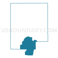
Outline

Summary
| Unique Area Identifier | 698552 |
| Name | GUTHRIE Voting District |
| County | Converse County |
| State | Wyoming |
| Area (square miles) | 507.82 |
| Land Area (square miles) | 507.60 |
| Water Area (square miles) | 0.21 |
| % of Land Area | 99.96 |
| % of Water Area | 0.04 |
| Latitude of the Internal Point | 42.51525140 |
| Longtitude of the Internal Point | -105.51061650 |
Maps


Graphs
Select a template below for downloading or customizing gragh for GUTHRIE Voting District, Converse County, Wyoming


Neighbors
Neighoring Voting District (by Name) Neighboring Voting District on the Map
- BOXELDER Voting District, Converse County, WY
- DON ROBBIN'S HOME Voting District, Albany County, WY
- DOUGLAS RURAL Voting District, Converse County, WY
- GLENDO Voting District, Platte County, WY
- LA PRELE Voting District, Converse County, WY
- ORIN Voting District, Converse County, WY
- SHARON WALKER'S HOME Voting District, Albany County, WY
Top 10 Neighboring County Subdivision (by Population) Neighboring County Subdivision on the Map
- Douglas CCD, Converse County, WY (9,537)
- Glenrock CCD, Converse County, WY (4,296)
- Glendo CCD, Platte County, WY (576)
- Rock River CCD, Albany County, WY (432)
Top 10 Neighboring Place (by Population) Neighboring Place on the Map
Top 10 Neighboring Unified School District (by Population) Neighboring Unified School District on the Map
- Albany County School District 1, WY (36,299)
- Converse County School District 1, WY (9,557)
- Platte County School District 1, WY (7,251)
- Converse County School District 2, WY (4,276)
Top 10 Neighboring State Legislative District Lower Chamber (by Population) Neighboring State Legislative District Lower Chamber on the Map
- State House District 6, WY (9,518)
- State House District 14, WY (9,049)
- State House District 3, WY (8,892)
Top 10 Neighboring State Legislative District Upper Chamber (by Population) Neighboring State Legislative District Upper Chamber on the Map
Top 10 Neighboring 111th Congressional District (by Population) Neighboring 111th Congressional District on the Map
Top 10 Neighboring Census Tract (by Population) Neighboring Census Tract on the Map
- Census Tract 9566, Converse County, WY (3,194)
- Census Tract 9565, Converse County, WY (2,807)
- Census Tract 9639, Albany County, WY (2,141)
- Census Tract 9591, Platte County, WY (2,092)
Top 10 Neighboring 5-Digit ZIP Code Tabulation Area (by Population) Neighboring 5-Digit ZIP Code Tabulation Area on the Map
- 82633, WY (9,592)
- 82201, WY (6,467)
- 82637, WY (4,136)
- 82213, WY (513)
- 82329, WY (359)
- 82058, WY (52)